Historical gold maps of the Victorian goldfields, showing useful info on reefs, leads, diggings, mines and geology. These maps are available to view online for free.
“These wonderful discoveries, which are rendered more dazzling by every succeeding mail, have spread a gold fever through the population of Victoria” – The Argus, Melbourne, 29th July 1851
This page provides a directory of historical gold maps for the entire state as well as many individual towns/regions across Victoria.
Historical gold maps of the entire state of Victoria
These state-wide maps offer a series of fascinating snapshots of the development of Victoria’s goldfields, including details such as known goldfields, roads to the diggings, illustrations, and notes on the landscape.
Some interesting features of these maps include:
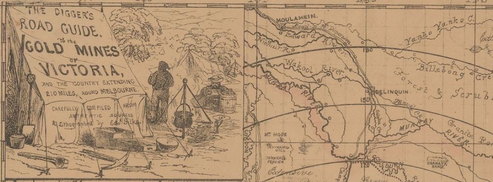
An illustration in the top left of the 1853 Diggers road guide to the gold mines of Victoria and the country extending 210 miles round Melbourne shows a pair of miners in their camp, with mining implements including pick, pan and cradle lying alongside the tent.
The 1853 pocket map of the roads to all the mines in Victoria includes an extensive list of distances from Melbourne to the various localities and goldfields around Victoria.
The 1860 general agricultural and goldfields map of Victoria shows a much more developed Victoria, and displays advertisements for General Outfitters and Boot & Shoe Importers on Russell Street, Melbourne.
Check out these historical gold maps of Victoria:
1853, Ham’s Squatting Map of Victoria
1853, Pocket map of the roads to all the mines in Victoria
1860, General agricultural and goldfields map of Victoria
Historical gold maps by town
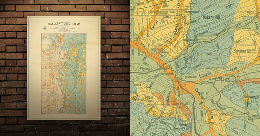
Shop historical goldfields maps, large high quality prints
Each town has its own page which includes a directory of links to local historical goldfields maps, free to view online.
Ararat
Avoca
Ballarat
Baringhup
Beaufort
Bealiba
Beechworth
Bendigo
Blackwood
Bright
Carisbrook
Castlemaine
Clunes
Creswick
Dunolly
Eaglehawk
Eddington
Enfield
Goldsborough
Heathcote
Inglewood
Jamieson
Kevington
Kingower
Majorca
Malmsbury
Maryborough
Mitta Mitta
Moliagul
Moonambel
Rushworth
Smythesdale
St Arnaud
Stawell
Talbot
Tarnagulla
Vaughan
Waanyarra
Walhalla
Warrandyte
Wedderburn
Yackandandah
Shop high quality prints
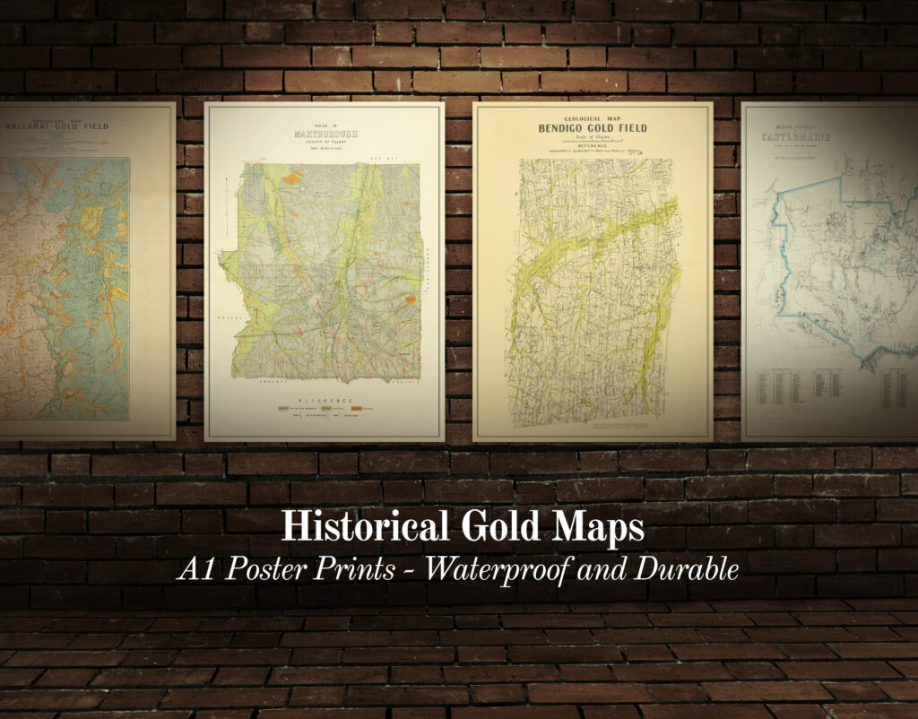
Shop our collection of historical goldfields maps, which show fascinating historical features in superb detail. High quality, durable A1 poster prints in a satin finish. Order yours today!