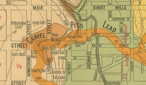
You may notice leads or deep leads marked on historical goldfields maps.
Gold which has broken away from its original location in a reef gets washed away over time by water and gravity, and is eventually deposited into creeks and rivers.
Many ancient gold-bearing creeks and rivers have been covered over by geological changes such as lava flows. These ancient river beds, buried beneath the ground, are called leads.
You will find leads marked on most gold maps, and you will notice they follow the same visual pattern as a modern day watercourse, with headwaters and tributaries leading into a river.
Leads were often discovered and traced from shallow areas, usually around the headwaters of the ancient river, then followed deeper underground. Miners processed the ancient riverbed for gold, and the amount they got was often beyond belief!
Shallow leads were worked relatively easily by gold miners, and you can see the remains of their diggings following the leads in many places throughout the goldfields.
The leads beneath Ballarat were notoriously difficult to work, and miners had to sink their shafts through many layers of rock and dangerous drift, often hundreds of feet deep.
The leads which were deeply buried by lava flows, such as the Berry Lead near Creswick, required substantial capital and equipment to work for gold. These leads were worked by large mining companies.
Exploratory boring to find the course of the lead was followed by the sinking of deep shafts, and massive pumping engines were required to keep the water at bay underground.
One thought on “Deep Leads”