One of the most famous goldfields of the Victorian gold rush, the renowned Forest Creek Diggings attracted thousands upon thousands of hopeful miners from all over the world! The rush here began in the latter part of 1851, and it was not long before the entire area was busy with diggers, tents, cradles and tin dishes, and seemingly endless ounces of gold were being obtained from the rich earth.
“The reports of large quantities of gold being found, have become so frequent, that it is now looked upon as quite common; but I think the present will throw all former ones in the shade. Yesterday a lump of pure, clean gold free from quartz, was obtained from the surface near Messrs. F-ntum & Edmiston’s new tent, weighing 60 ounces.” – The Argus, 29th November 1851
This page provides a directory of historical gold maps for Castlemaine, Victoria. All these maps are available to view online for free.
Castlemaine historical gold maps
- 1854, geological sketch of the country in the vicinity of Mnt Alexander. Shows granite, metamorphosed paleozoic strata, basalt, dip of strata, strike and position of the chief auriferous quartz veins of Forest Creek and Bendigo.
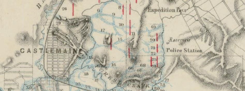
- 1860, mining district of Castlemaine, Mining Department. Shows reefs, gullies, gold workings across four divisions – Castlemaine, Tarrengower, Hepburn, and Fryer’s Creek.
- 1864, Geological Survey of Victoria. Parts of parishes of Muckleford, Castlemaine, Chewton, Yandoit, Strangways, Guildford and Tarrengower. Shows quartz reefs, copper, zinc, lead, manganese, iron, dips, strikes, dykes, post pliocene, newer pliocene, older pliocene, lower silurian, upper volcanic, slate, sandstone, clay, gravels, more. Includes detailed notes.
- 1866, Castlemaine, compiled and drawn by R. Hicksh from surveys of Mining Surveyor Brown. Shows reefs, gullies, gold workings, locations of crushing machines.
- 1902, plan of the Chewton-Castlemaine gold field. Shows reefs, dykes, dip of strata, anticlinal folds, synclinal folds, anticlinal axial lines, alluvial, lower level hill gravels, higher level hill gravels, slates, flags and sandstones, granite.
Purchase high quality A1 print of the Castlemaine Mining District
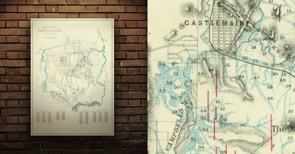
Shop now – High quality A1 print – Historical map of the Castlemaine Mining District