“Good coarse gold has been struck at a depth of 20ft at Bryant’s Cairn Curran Station, at Baringhup by Hamilton and party. There is 5ft of gold bearing wash, and the prospects are excellent. A second shaft 700ft distant bottomed on good prospects. Five claims are being worked. The water is heavy.” – The Argus, 30th December 1896.
Baringhup was a picturesque mining, agricultural and dairying district set along the beautiful Loddon River.
Today it is a quiet locality and a brilliant destination for holidays, with a great caravan park set along the river, close to the large Cairn Curran Reservoir – a local favourite for swimming, boating, fishing and walking.
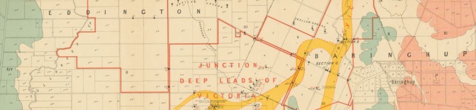
Baringhup gold maps
- 1899, Berry-Moolort-Loddon deep lead system. Boring operations in the parishes of Eddington, Carisbrook, Neereman, Baringhup and Moolort. Shows boring operations, leads, silurian and granite. Also includes diagrams – sections of bores.