Originally known as the Yam Holes Diggings, Beaufort was named in 1858 after Rear-Admiral Sir Francis Beaufort (1774-1857), who introduced the Beaufort Scale of Wind Force to the Royal Navy.
I write a line: in haste to tell you of a tremendous rush to the YamHoles, or rather Fiery Creek. The road to them from this place lies through Burn Bank, or Daisy Hill, and the creek in question is situated some twelve miles from the former township. The diggers were rushing to this locality from all quarters, Ballaarat included, and the road reminds a traveller more of the old Bendigo times than anything which has occurred in these degenerate days. – The Argus, 6th September 1855
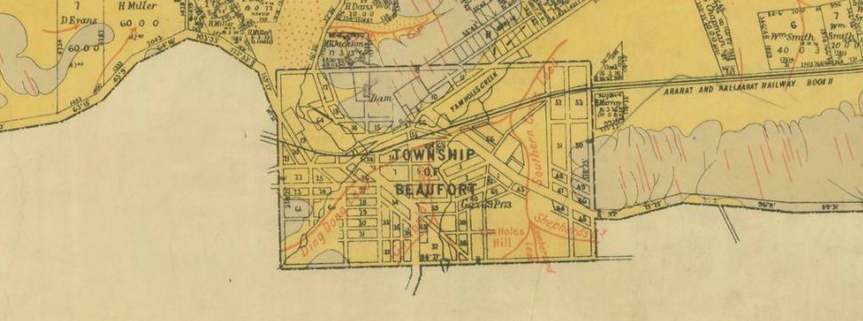
Beaufort gold maps
- 1858, township of Beaufort, Public Lands Office. Shows location of the Yam Hole Diggings.
- 1889?, Beaufort, County of Ripon, Crown Lands Dept. Shows leads, surface workings, alluvial, tertiary and silurian.