If you’re just starting out prospecting and/or seeing some of the terms used on these historical gold maps for the first time, things can get a little confusing. We’ve put together a quick guide to what some of these terms mean.
Pliocene, silurian, ordovician, palaeozoic etc
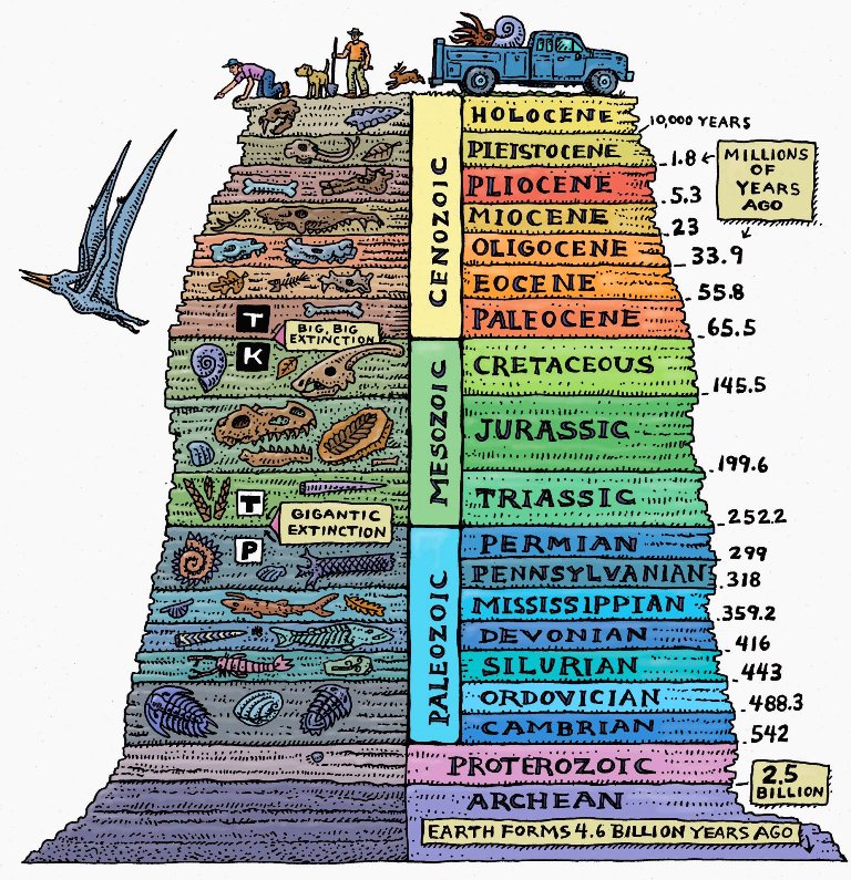
These are probably the most immediately confusing terms on historical gold maps. Don’t let this put you off! These terms are simply referring to the age of the ground in question, using the geological time scale. If you’re interested, you can learn more about geological time periods here.
Reefs
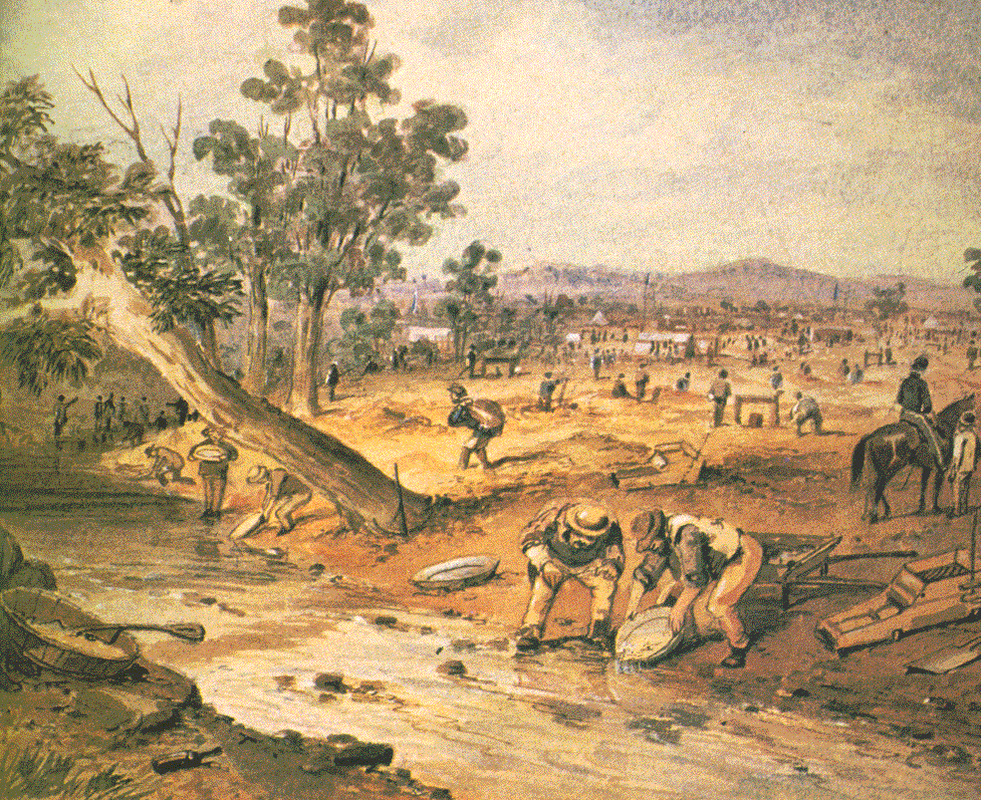
Reefs are typically shown on historical goldfields maps as red or black lines. A reef is a vein of quartz in the ground, often gold-bearing. Gold from reefs in the Victorian Goldfields can either be mined directly from the reef (by crushing the quartz and processing for gold) or from nearby areas where the gold has been washed away from the reef over time (this is called alluvial mining). Modern day gold prospectors are usually after this alluvial gold, which can be found in the ground or trapped in creek beds. Tools for extracting alluvial gold from the ground include gold detectors, gold pans, and gold sluices.
Quartz outcrops/blows
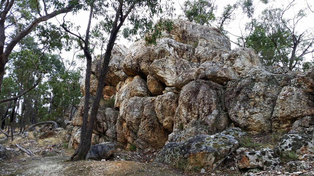
Reefs can be located deep underground, but a quartz outcrop refers to a reef which is exposed at the surface. These can also be marked on the maps as a ‘quartz blow’ or simply ‘blow’. The image above shows a massive quartz outcrop in Lillicur, which contained so little gold that the old time miners left it for us to see today (please note that prospecting is not permitted at the Quartz Mountain Geological Reserve). Many exposed quartz reefs have been extensively mined in the past (like at Dunn’s Reef in Muckleford), and while you won’t find another one as big as Quartz Mountain, you’ll still come across plenty of smaller ones out the bush.
Alluvial gold workings / diggings
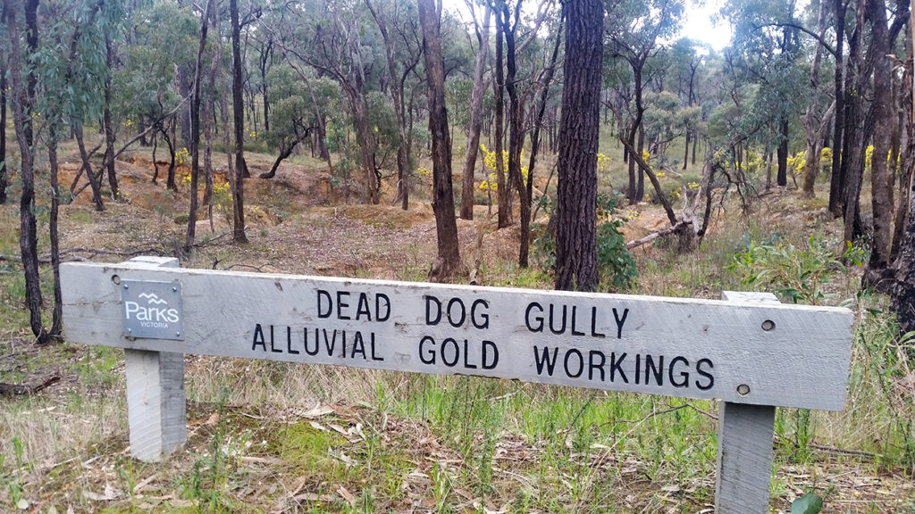
Alluvial gold is gold which has come loose from its original host and is then moved/deposited by water. On historical gold maps, diggings, gold workings, alluvial diggings, alluvial workings, etc, all refer to areas where alluvial gold mining has occurred. This includes surfacing, creek workings, sinking shallow shafts to reach buried leads, gold puddling sites, etc.
Leads
Gold which has broken away from its original reef gets washed away and is often deposited into creeks and rivers. Many ancient gold-bearing creeks and rivers have been covered over by geological changes such as lava flow. An ancient gold-bearing river bed, buried beneath the ground, is called a lead.
Shafts
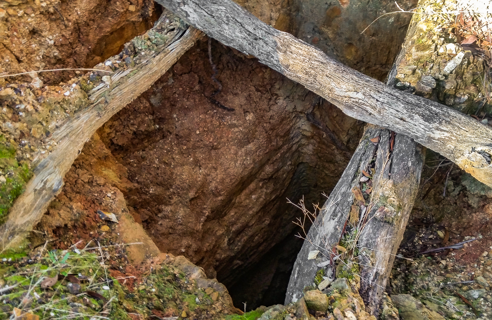
Shafts are vertical entrances to underground gold mines. Many of these are still open today, be wary of the dangers of mine shafts while gold prospecting in the Victorian Goldfields.
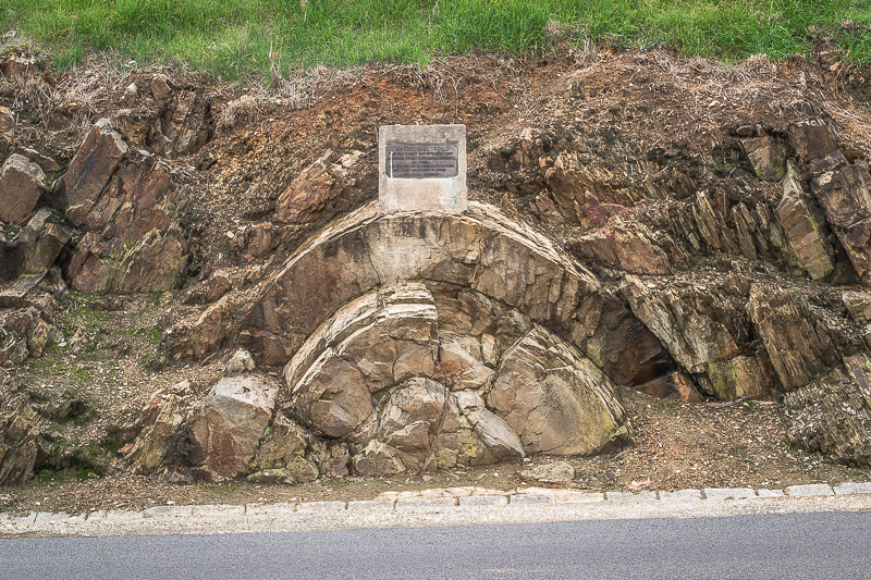
Anticline and syncline
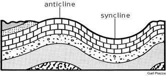
These terms are describing arch-like folds in the rock layers. A syncline is a fold where the youngest rocks occur in the core of the fold. In an anticline, it is the oldest rocks which occur in the core.
Mindat.org provides the following concise definition of a saddle reef, in relation to an anticlinal fold: “A saddle reef is a mineral deposit associated with the crest of an anticlinal fold and following the bedding planes, usually found in vertical succession, esp. the gold-bearing quartz veins of Australia”.
I hope this quick guide to some of the terms found on historical goldfields maps has been handy for people who are just starting out gold prospecting and/or have never come across these terms before.