Historical gold maps of the Northern Territory goldfields, showing useful info on mines, mining districts, and geology. These maps are available to view online for free.
Historical gold maps of the entire territory
1897, Plan of the Northern Territory of South Australia. Shows gold mining districts.
1912, Geological map of the Northern Territory of Australia
1917?, Northern Territory with stock routes. Shows some gold and tin fields.
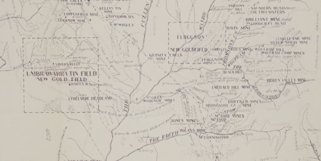
1920, Plan showing metalliferous area : gold mining district A from 70 to 220 miles south from Port Darwin, Northern Territory. Shows Umbrawarra, Ferguson, Daly River, Mary River, Adelaide River
1922, General map of the Northern Territory of Australia. Shows gold mining districts.