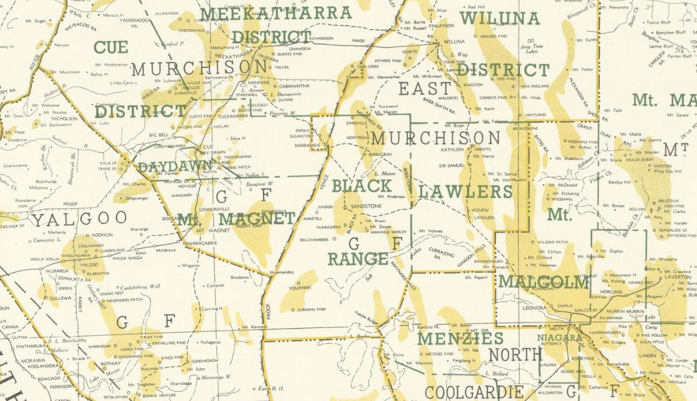
Historical gold maps of the Western Australian goldfields, showing useful info on reefs, leads, diggings, mines and geology. These maps are available to view online for free.
“Melbourne, Tuesday – The exodus from Victoria to the newly-discovered goldfields in Western Australia show no signs of abating. Huddart, Parker and Co.’s steamer Tasmania started on her second voyage … The majority of the passengers were miners and labourers…” – 19th August 1893
Historical gold maps of the entire state of Western Australia
- 1890-96, plan showing routes to Yilgarn, Coolgardie & Dundas goldfields. Shows quartz reefs, shafts, mining leases, machinery areas, water rights, granites, greenstones, felsite.
- 1892-97, the consolidated gold mines of Western Australia. Map showing some of the gold discoveries made by A.F. Calvert, M.E. in North West Australia, Coongan gold mine, Marble Bar, North West Australia. Shows locations of Kimberley, Pilbara, Ashburton, Murchison, Yilgarn and Coolgardie gold fields.
- 1893, new map of Coolgardie and Murchison gold-fields, shewing all routes from latest government maps. Map of Southwestern Western Australia showing administrative land divisions and goldfield boundaries.
- 1896, map of the West Australian gold fields. Four separate maps, use the links “up/down a level” to view all four maps. Map of Western Australia highlighting the goldfields identified to date across the state. Shows Murchison, Central Western Australia, Perth District, and Coolgardie goldfields.
- 1900, map of Western Australia. Shows goldfields, agricultural areas, towns, boundaries, stock routes, telegraph lines.
- 1904, map of the Central Goldfields. Shows goldfields and mining districts, gold mining leases, govt wells, private wells, batteries (with number of stamp heads). Includes parts of Murchison, East Murchison, Yalgoo and Peak Hill goldfields.
- 1906, portion of Western Australian gold fields. Shows mining area boundaries, topography, roads, tracks, railroads, stock routes.
- 1911, map of Western Australia. Shows land district boundaries, goldfields, towns, stock routes, railways, telegraph lines.
- 1934, locality map of Western Australia showing gold fields and mining centres. Shows boundaries of gold fields, boundaries of oil prospecting areas, includes list of mining company leases.
- 194?, Western Australia, showing gold bearing areas. Map of the whole state showing gold bearing areas on a topographic base.
- 1958, Western Australia goldfields. Shows state-wide goldfields, districts and gold bearing areas.
Historical gold maps by town/region
Coolgardie
Kalgoorlie
Kimberley
Menzies
Murchison
Peak Hill
Pilbara
Yalgoo
Yerilla
Shop high quality prints
Shop our collection of historical goldfields maps, which show fascinating historical features in superb detail. High quality, durable A1 poster prints in a satin finish. Order yours today!


