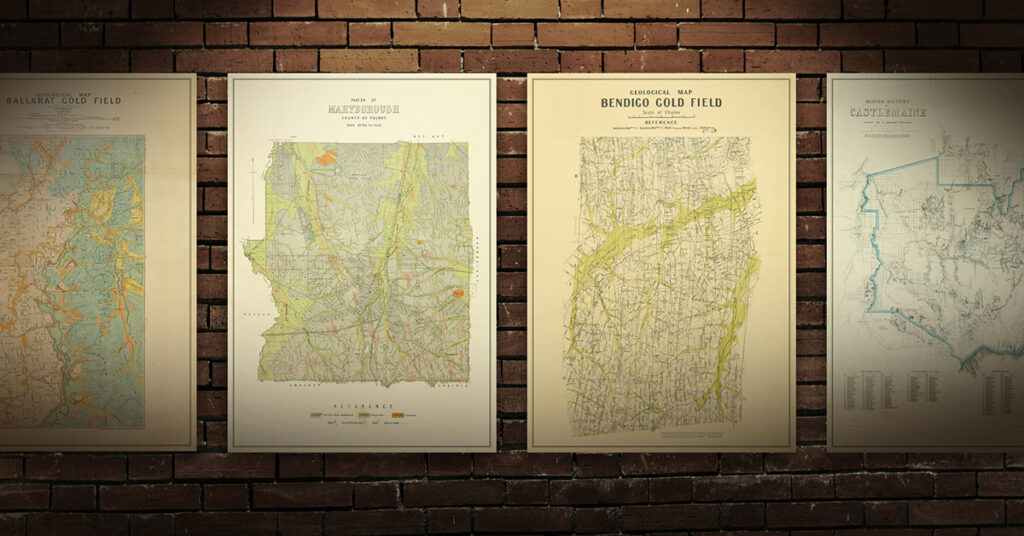
Historical gold maps of the Queensland goldfields, showing gold workings, mineral occurrences and geological information. These maps are available to view online for free.
“Within the last few weeks attention has been directed to a place called Gympie in the Maryborough district, where gold has been found in payable quantities, and to which a large number of diggers have directed their steps … The Government has proclaimed it a goldfield and an escort has been organised between it and Brisbane. The discovery has created considerable excitement in Queensland…” – Freeman’s Journal (Sydney), 23rd November 1867
Shop our collection of historical goldfields maps, which show fascinating historical features in superb detail. High quality, durable A1 poster prints in a satin finish. Order yours today!
Historical gold maps of the entire state of Queensland
The following maps are all available to view online for free.
- 1869, map of the Burke and Kennedy districts, North Queensland. Includes Mackay, Bowen, Townsville, up to Princess Charlotte Bay, and inland to Burketown. Shows gold fields, diggings, towns, bush tracks, mail routes or surveyed roads, settled districts, towns, pastoral and station homesteads.
- 1871, map of Queensland, compiled by the late Thomas Ham. Shows gold fields, tracks and routes, telegraph lines, towns, stations, railways.
- 1872, map of Queensland, compiled from the latest official Government surveys. Shows goldfields, boundaries, roads, towns, telegraph lines, railroads.
- 1874, map of Queensland, compiled from the latest official Government surveys, showing the recently discovered goldfields. Highlights Ravenswood goldfield, Charters Tower diggings, Cape River goldfield, Gilbert goldfield, Cloncurry goldfield, Palmer diggings, Gympie goldfield.
- 1874, map of Queensland, including Hann’s explorations and Dalrymple’s discoveries. Shows goldfields, towns, boundaries, roads, railroads, telegraph lines.
- 1882?, map of Queensland shewing mineral areas. Shows gold, coal, copper, tin, antimony, railways.
- 1886, map of Queensland illustrating its mineral and other productive capabilities. Shows gold and mineral fields, towns, railways (completed and under construction).
- 1886, geological map of Queensland, Dept of Public Works and Mines. Shows geological formations and mineral occurrences.
- 1905, geological sketch map of Queensland showing mineral localities. Shows goldfields with dates of proclamations, mineral fields, opal fields and mines in operation, partly prospected localities where opal has been obtained, localities where opal is known to occur.
- 1914, sketch map of gold & mineral fields Wide Bay & Burnett districts, Department of Mines, Brisbane. Includes St Johns Creek Goldfield, Eidsvold Goldfield, Kilkivan Goldfield, Marodian Goldfield, Glenbar Gold and Mineral Field, Mount Steadman Goldfield, Mt Shamrock Goldfield, Paradise Goldfield, Stanton Harcourt Goldfield, Perry Goldfield, Reid Creek Goldfield, Tenningering Mineral Field, Boolbunda Goldfield, Cania & Kroombit Goldfield, Monal Goldfield, Glassford Mineral Field, Bompa Goldfield, Gaeta Goldfield, Rosedale Mineral Field. Also shows indexes of gold and mineral leases and dredging claims.
- 1920, Queensland, showing principal mining centres and railways, Department of Mines, Brisbane. Includes entire state, shows map and index of 136 gold and mineral fields.
- 192?, Queensland, showing combined agricultural, pastoral & mineral districts. Shows gold, other minerals, sheep, cattle, dairying, wheat, tropical fruit, temperate fruit, cotton, sugar, tobacco, pearl shell, timber.
- 1935, sketch map of Cape York Peninsula gold & mineral fields, Department of Mines, Brisbane. Includes Alice River, Batavia, Bowden, Coen, Cooktown, Hamilton, Hayes Creek, Lochinvar, Palmer, Potallah, Rocky River & Starcke. Shows Palmer Goldfield, Cooktown Mineral Field, Starke Goldfield, Alice River Goldfield, Hamilton Goldfield, Coen Goldfield, Rocky River Goldfield. Also shows index of gold and mineral leases. Far North Queensland, FNQ.
Historical gold maps by town/region
Useful resources
- Fossicking in Queensland. QLD Government, area maps, fossicking information, rules and responsibilities.
- Outdoors Queensland: Fossicking tips and resources. Lots of helpful information and links.
- The Goldfields of Queensland, book, 1899. Digitised and freely available to read online. A fascinating insight into the mining operations and goldfields of Queensland in the late 19th century. Lots of historical photographs, descriptions and information.
- Geology and Mineralisation of the Texas Region, South-Eastern Queensland, book, 2007. Digitised and freely available to read online / download PDF. Queensland Department of Mines and Energy.
- Prospecting at Palmerville Station


