The Clunes Diggings struck fame as the first marketable gold field in Victoria, beginning in July 1851.
The operations at the Clunes Diggings were more accurately described as ‘mining’ than ‘diggings’, as the gold was primarily being obtained from the quarrying of quartz veins rather than the washing of alluvial material.
Although the Clunes gold field was not ideal for the early diggers of Victoria, who soon rushed to the rich alluvial fields of Ballarat, Mount Alexander and Bendigo, the Port Phillip and Colonial Gold Mining Company entered the scene in 1857 and began their lucrative operations, investing heavily in equipment and amassing a great wealth from the quartz reefs at Clunes.
“…the quartz veins have, where they have been attacked, proved so rich that a large profit might be reasonably anticipated from the use of stamping machines, together with buddles, quick-silver machines, and the other appliances of legitimate mining.” – Geelong Advertiser, 8th August 1851
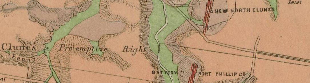
Clunes historical gold maps
- 1883, Clunes, Mt Greenock and Talbot gold fields, Mining Dept. Shows outcrops of quartz reefs, quartz reefs proved auriferous, strike and dip of rocks, points of volcanic eruption, gold workings, alluvial, post pliocene, newer volcanic, upper pliocene, lower pliocene, lower silurian, granite, and trappean.